The land use and growth management aspects of the Urban Development Strategy are primarily implemented through the Resource Management Act 1991 Documents. These include the Canterbury Regional Policy Statement, Regional Plans, Mahaanui Iwi Management Plan, and District Plans.
The Partnership has recently undertaken a review of the strategic land use planning framework for Greater Christchurch. Our Space 2018-2048: Greater Christchurch Settlement Pattern Update [PDF, 6.4 MB] outlines land use and development proposals to ensure there is sufficient development capacity for housing and business growth across Greater Christchurch to 2048.
More information on Our Space and its development.
Canterbury Regional Policy Statement
 The Canterbury Regional Policy Statement(external link) gives an overview of the significant resource management issues facing the Canterbury region and sets out objectives, policies and methods to resolve those issues.
The Canterbury Regional Council and territorial authorities in the region must give effect to the Canterbury Regional Policy Statement through their regional and District Plans. Chapter 6 of the Canterbury Regional Policy Statement, inserted by the Land Use Recovery Plan in December 2013, sets out objectives and policies specific to greater Christchurch relating to land use and development.
Within chapter 6, 'Map A' shows the settlement pattern for greater Christchurch to 2028. The map also identifies greenfield priority areas for business and residential development. A projected infrastructure boundary shows the planned extent of urban development in greater Christchurch after 2028. Key features of the Urban Development Strategy which are also anchored in this chapter include; consolidation of urban areas, integration of land use and infrastructure and the network of Key Activity Centres.
Mahaanui Iwi Management Plan
The Mahaanui Iwi Management Plan provides a policy framework for the protection and enhancement of Ngāi Tahu values, and to achieve outcomes that provide for the relationship of Ngāi Tahu with the natural environment.
The plan outlines the regional issues and policy in the following areas:
- Kaitiakitanga/Governance and guardianship
- Wai Māori/Freshwater
- Nga Tutohu Whenua/Cultural landscapes
- Ranginui/Sky
- Papatuanuku/Land
- Tane Mahuta/Forest
- Tangaroa/Oceans
- Tawhirimatea/Climate change
The plan also outlines catchment issues and policy, including for the three catchments within (or partially within) the UDS boundary; Ihutai, Waimakariri and Rakahuri.
 Land Use Recovery Plan - Te Mahere Whakahaumanu Tāone
The Land Use Recovery Plan (LURP) (external link)is a statutory document which was prepared under the Canterbury Earthquake Recovery Act 2011 (CER Act).
The Plan sets a policy and planning framework necessary for metropolitan greater Christchurch to rebuild existing communities; develop new communities; meet the land use needs of businesses; rebuild and develop the infrastructure needed to support these activities, and take account of natural hazards and environmental constraints that may affect rebuilding and recovery.
More information on the development of the LURP, the LURP and the LURP review
The Greater Christchurch Transport Statement
 The Greater Christchurch Transport Statement (GCTS) [PDF, 701 KB] is an overarching framework for integrated transport planning and network development within the Greater Christchurch area.
It is designed to guide the city's 10 transport providers in the development and management of the Greater Christchurch transport programmes and the partners' investment strategies to ensure a 'one network' approach.
Primarily, the GCTS focuses on the strategic links between key places within the Greater Christchurch area, with the partners committed to looking ahead and working together to deliver better outcomes which build resilience, efficiency and reliability into the transport network, at the same time ensuring the community is provided with sustainable transport choices.
The partners of the Greater Christchurch Transport Strategy are the Urban Development Strategy signatories - the Christchurch City Council, Selwyn District Council, Waimakariri District Council, Environment Canterbury and the NZ Transport Agency - as well as the Christchurch International Airport, the Lyttelton Port of Christchurch, KiwiRail, Ministry of Transport and previously the now disestablished Canterbury Earthquake Recovery Authority (CERA).
Canterbury Regional Public Transport Plan 2018-2028
The Canterbury Regional Public Transport Plan is a legislative document that sets out Environment Canterbury’s objectives and policies for delivering public transport in Canterbury.
It describes the services Environment Canterbury propose to provide in the future to meet the needs of new and existing customers and the policies which those services will operate by.
It also explains how they will work in partnership with operators and territorial authorities in the region.
Canterbury Regional Land Transport Plan 2015-2025 (revised 2018)
The Canterbury Regional Land Transport Plan is prepared by the Regional Transport Committee(external link) and outlines the current state of our regional transportation network and the challenges we face now and in the future.
The priorities in the plan reflect the context of regional, national and international events and trends.
The programmes and projects in it are the regional responses to these challenges and include actions for Canterbury’s regional and district councils and the New Zealand Transport Agency.
Review of the Regional Land Transport Plan
The plan underwent a mid-term review, as required by the Land Transport Management Act 2003, and the revised plan was issued in June 2018.
Canterbury Regional Land Transport Strategy 2012-2042
The Canterbury Regional Land Transport Strategy (RLTS) is prepared under the Land Transport Management Act (2003), and sets the strategic direction for land transport within the Canterbury region over a 30 year period. The RLTS contributes towards the government’s overall vision of achieving an integrated, safe, responsive and sustainable land transport system. The RLTS identifies the regions transport needs, and looks at the role of all land transport modes.
Canterbury Regional Land Transport Strategy 2012-2042 [PDF, 1.5 MB]
Canterbury Regional Land Transport Strategy 2012-2042 - Appendices [PDF, 1.1 MB]
The Christchurch Roads of National Significance Programme
This programme covers three transport corridors; Christchurch Northern, Christchurch Western and Christchurch Southern. These corridors will provide access to and from the Christchurch central business district, Christchurch International Airport and the Port of Lyttelton. All of the Christchurch Roads of National Significance projects (external link)are included within the UDS, and are integral in achieving the UDS vision of a sustainable transport system that supports prosperous communities.
Christchurch Transport Strategic Plan
The Christchurch Transport Strategic Plan 2012-2042 [PDF, 4.8 MB] sets out a 30 year vision for transport within the city. The plan was adopted by Christchurch City Council in late 2012.
Greater Christchurch Northern Rail - Rapid Assessment Report
Environment Canterbury [PDF, 6.8 MB] commissioned a report looking at the feasibility and indicative costs of providing a short term passenger rail service on the existing rail corridor.
The report was a rapid assessment and found that based on the risks identified with delivering a successful service, a short-term passenger rail system was not considered a feasible option.
Christchurch Central Recovery Plan
An Accessible City(external link) is the transport chapter of the Christchurch Central Recovery Plan. Recent progress and related central city activity include:
- Completion of the central Bus Interchange
- Changes to one-way or two-way roads
- Introduction of a 'slow core 30km/ph' zone
- Cycle priority measures linking to the wider investment in city cycleways
- Development of a Parking Plan
- Implementation of public realm improvements
Christchurch Central City Parking Plan
The Christchurch Central City Parking Plan (external link)(the Parking Plan) enhances certainty by providing information about the current availability of parking within the central city, along with information on future provision. Both on-street and off-street vehicle parking is included. Information on future cycle parking needs is also provided in the plan.
The parking plan is a non-statutory document, and forms part of the An Accessible City work programme. The Parking Plan plays an important part in the larger plan for An Accessible City helping make it easier for people, cars, bicycles and public transport to get to Christchurch Central and move around.
Christchurch Central Realm Network Plan - Streets and Spaces Design Guide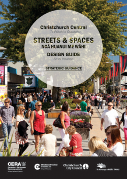
This design guide(external link) was published to promote a people-centred central city, with a network of gathering places and streets, and public realm projects. The purpose of the guide is to provide design and delivery guidance for the public realm works to be delivered through the following:
- The Christchurch Central Recovery Plan anchor projects
- Accessible City transport projects
- Christchurch City Council’s Long Term and Annual Plans
Greater Christchurch Freight Study and Action Plan
UDS partners have finalised a Greater Christchurch Freight Study. The Study is a response to a number of the Greater Christchurch Transport Statement (GCTS) actions and the Land Use Recovery Plan (LURP) Action 40. It was led by the New Zealand Transport Agency in collaboration with Christchurch City Council, Waimakariri District Council, Selwyn District Council, and Environment Canterbury, and is supported by Lyttelton Port of Christchurch, KiwiRail and Christchurch International Airport Limited.
The study was undertaken in three steps with sub-reports as follows:
-
The Freight Demand Statement [PDF, 2.7 MB] which assessed origins and destinations of demand; assessment of freight by commodities, freight hubs and generation points. This provided validation of the GCTS growth forecasts with the addition of a range of forecasts.
- The Freight Infrastructure Statement assessed current infrastructure capacity, supply chain capability and identified constraints and opportunities for the future.
- The Freight Management Directions Statement builds on the other two documents. It provides recommendations for further optimisation and improvements to the freight network and management practices.
The consultant's recommendations have been considered and where appropriate incorporated into the Greater Christchurch Freight Action Plan [PDF, 276 KB] agreed by UDS Partners. The action plan can be summarised into the following general areas:
- Improving capacity and efficiencies at the Lyttelton Port of Christchurch (LPC)
- Improving road corridor capacity between Rolleston and Lyttelton Port (including Brougham Street and Lyttelton Tunnel)
- Protecting freight corridors and land areas adjacent to freight activities
- Developing an inland port(s) and adjacent freight precinct at Rolleston
- Rail improvements through Christchurch and at LPC
- Improved rail-yards and capacity
- Grade separating rail and road at key locations (such as around Middleton)
- Optimising use of the existing networks by the time of day and logistics management
- Improving the High Productivity Motor Vehicle network
- Improvement of north and west corridors
- One Network Road Classification implementation
- Increasing air-freight opportunities
- Resilience across the network including re-opening of Sumner Road
The Greater Christchurch Freight Action Plan(external link) will be included as part of the overall programme for collaborative working on transport through the UDS governance and management arrangements.
Greater Christchurch Public Transport Joint Committee
The Greater Christchurch Public Transport Committee was established in early 2016. The Joint Committee involves Environment Canterbury (who operate the buses), and Christchurch City Council, Waimakariri District Council and Selwyn District Council, (who manage the roads and provide the bus stops). This will result in a strategic, integrated approach to the service to enable the future development of the service.
Agendas and minutes of the Greater Christchurch Public Transport Committee can be found on the Environment Canterbury Council agenda and minutes page.(external link)
Urban Cycleway Projects
Projects are underway in Christchurch, (external link)Waimakariri (external link), Selwyn(external link) Districts to provide improved safety for cyclists, and increased transport choice for Greater Christchurch residents.
30 Year Infrastructure Strategies
The 2014 amendment to the Local Government Act 2002 required a 30 year strategy to be prepared for the infrastructure assets managed by territorial authorities and regional councils.
Local authorities are required to include water supply; sewerage and the treatment and disposal of sewage; stormwater drainage; flood protection and control works; and the provision of roads and footpaths. Other assets may be included at the local authority’s discretion.
The 30-year Infrastructure Strategies for each of the partner councils can be found here: Environment Canterbury [PDF, 6 MB], Christchurch City Council [PDF, 4.1 MB], Selwyn District Council [PDF, 2.4 MB], Waimakariri District Council [PDF, 5.4 MB].
SCIRT
The Stronger Christchurch Infrastructure Rebuild Team (SCIRT) is responsible for rebuilding horizontal infrastructure in Christchurch following the earthquakes of 2010 and 2011.
Lyttelton Port Recovery Plan
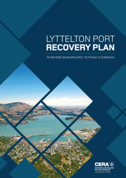 The Minister for Canterbury Earthquake Recovery directed the preparation of the Lyttelton Port Recovery Plan(external link).
Environment Canterbury developed the draft Lyttelton Port Recovery Plan in consultation with the strategy partners and the community.
The final recovery plan, gazetted in November 2015, provides a streamlined regulatory framework for the rebuild and repair of port infrastructure.
The Plan provides for a large reclamation for future development, allowing some port activities to be shifted from the inner harbour, which can then be redeveloped for commercial and community purposes.
The organisations involved in the plan have committed to the development of a catchment management plan for Whakaraupō/Lyttelton Harbour, a Memorandum of Understanding to address transport matters, facilitation of pedestrian access across Norwich Quay and to Dampier Bay, and future cruise ship berth solutions.

